
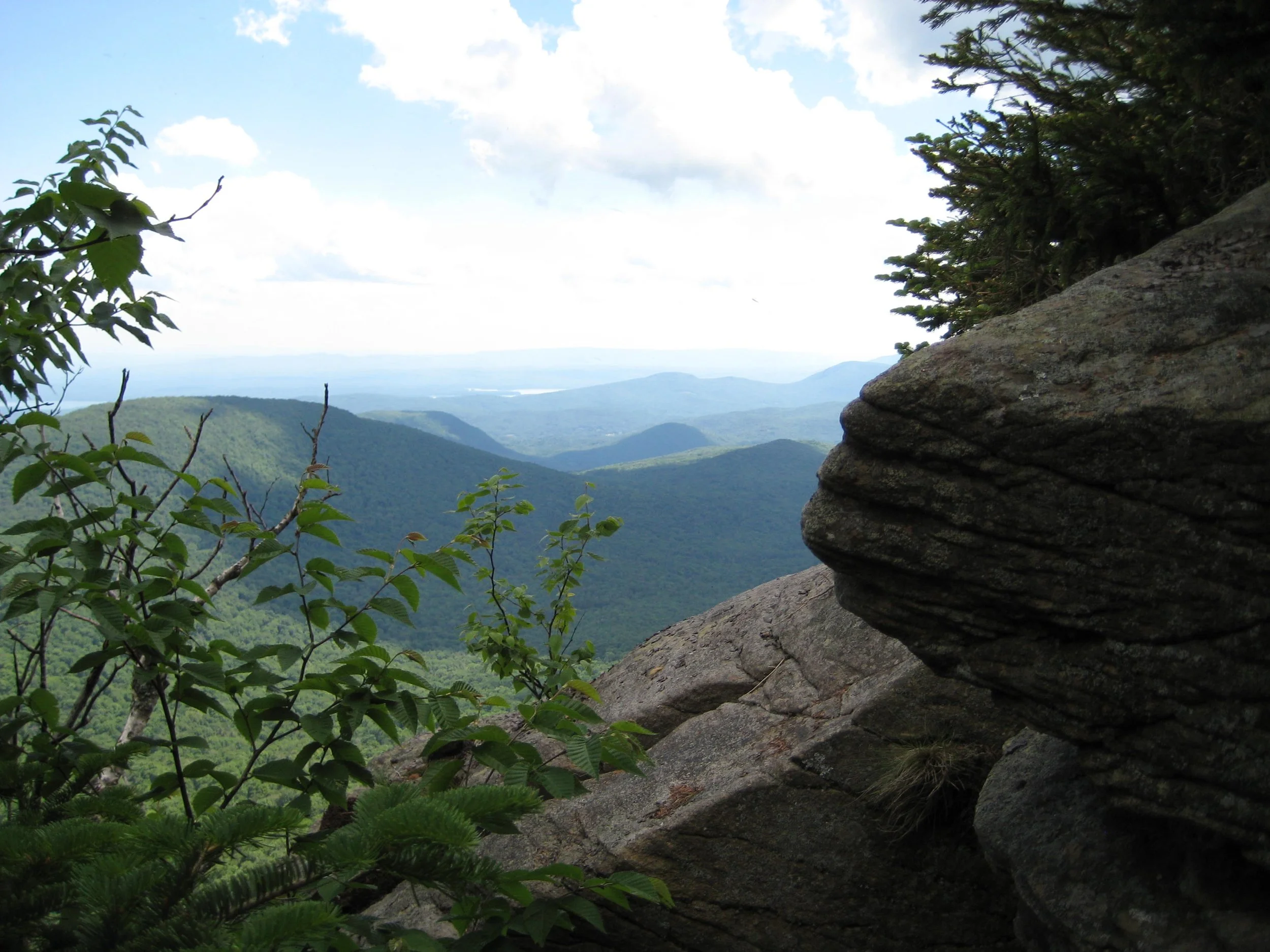
This 10-mile hike traverses the easter section the Devil’s Path -- Plateau (3835'), Sugarloaf (3783'), Twin (3650'), and Indian Head (3573'). Rated as difficult, this hike has great views and is expected to take eight hours to complete. We will hike at a moderate pace (about 1-1/2 mph moving speed), with short breaks. Hikers should bring water/ sports drink, lunch/ snacks, sturdy boots, proper clothing, insect repellent, and a headlamp. Hiking poles are recommended.
This event is limited to 12 registrants and registration is required before April 27. To register, contact event leader Marv Freedman at marvfreedman@gmail.com Dogs are permitted only with the permission of the event leader.
Directions: To reach the Devil’s Path, Prediger Road Trailhead from State Route 23A in Tannersville, take South Main, stay left on Spruce (becomes Platte Clove Rd.) and at 1.5 miles stay left on Platte Clove Road and continue another 4.3 miles and turn right on Prediger Rd. The parking area is located off the end of this short road on the right.
From Route 23A west, take a right on Bloomer Road (.6 miles after the 23A/ 214 jnctn). Just after a mile stay to the right at the yield signs and onto Platte Clove Road (Co. Hwy. 16). From this point, continue on Co. Hwy. 16 for 4.3 miles and turn right on Prediger Rd. The parking area is located off the end of this short road on the right.
GPS Coordinates for Prediger Rd. Parking Area: 42.13391, -74.10368
Note: This is where our hike will end. We'll leave most cars here and will caravan to the end of Mink Hollow Road in Elka Park to start our hike.
Note: Prediger Road can be approached by ascending Platte Clove Road from West Saugerties; however, Platte Clove Rd. (gorge section) is a seasonal road and although it is scheduled to open on April 15, there is no guarantee that it will be open.
Additional Information: Meeting place and time, route details, and required gear are subject to change based on weather forecast, trail conditions, etc. Updated information will be provided via email, usually about 4 days before the hike.