
News
Sample Newsletter
Click on the image below to link to a sample newsletter.

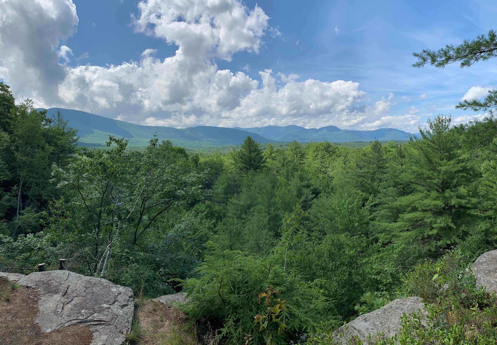
Hike Balsam and Eagle Mountains – Saturday, May 20 2023 8:30 AM
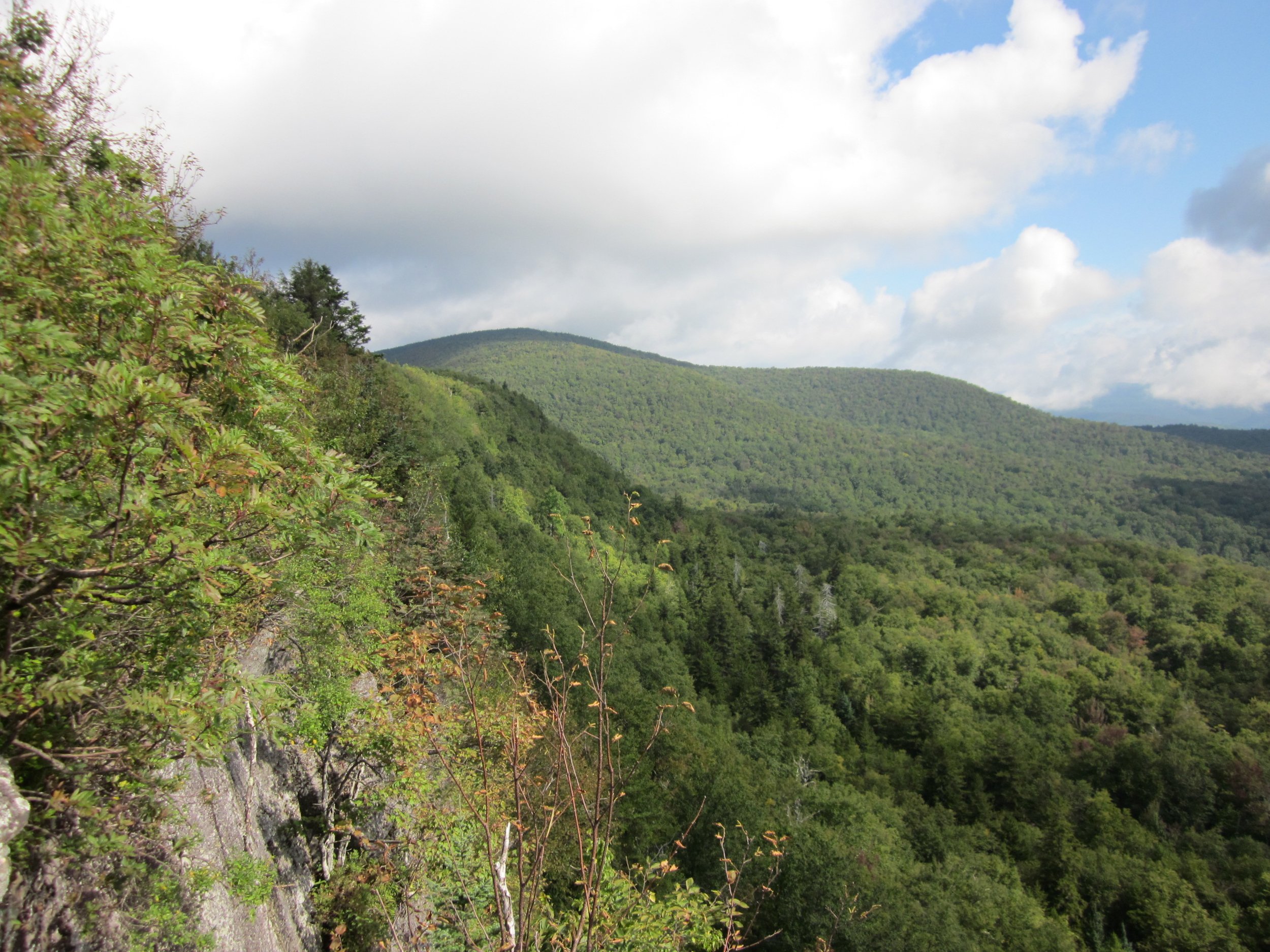
This is a strenuous 10-mile hike up to Balsam (3,610 ft) and Eagle (3,610 ft). We'll take Mine Hollow Trail (yellow) to Balsam via the Pine Hill West Branch Trail (blue), looping up to Balsam Mountain to its overlook point. After Balsam, we'll head over to Eagle and climb Haynes Mountain en route (one of the Catskill 100s). While there isn't a view at Eagle it’s a very nice walk in the woods! After Eagle, we'll retrace our steps and return to our cars via the Rider Hollow Trail (red). There are a couple of streaming crossings which may or may not be difficult towards the end of our hike so please make sure to wear waterproof shoes.Event Duration: 10 miles, 7 hoursLevel of Difficulty: DifficultLeader: Siu S YuenBring: 2 liters of water, lunch/snacks, sunscreen, bug spray and most importantly, sturdy waterproof hiking bootsRegistration required by 6PM 5/19/23. Register by contacting the leader: ssyuen@msn.comDogs allowed: NoAdditional Information: Rain Date: Sunday, 5/21/2023; Limit on number of hikers: 12.Driving and Meeting Directions:From exit 19 in Kingston, take State Route 28 west for 34.9 miles to Highmount (top of hill), turn left onto Galli Curci Rd / County Hwy-49A; stay on this road for 4.9 miles, then turn left onto Rider Hollow Rd. and go 2.1 miles to the trailhead/ end of road.From the west, take State Route 28 east past Margaretville toward Arkville and follow the brown-and-white signs for Dry Brook Ridge, turning right on Dry Brook Road. Take Dry Brook Road 4.7 miles, see sign for Rider Hollow, turn left and go one-half mile, see sign for Rider Hollow, turn right and go 2.1 miles to the trailhead/ end of road.GPS coordinates of meeting place: N42.1019 W74.5170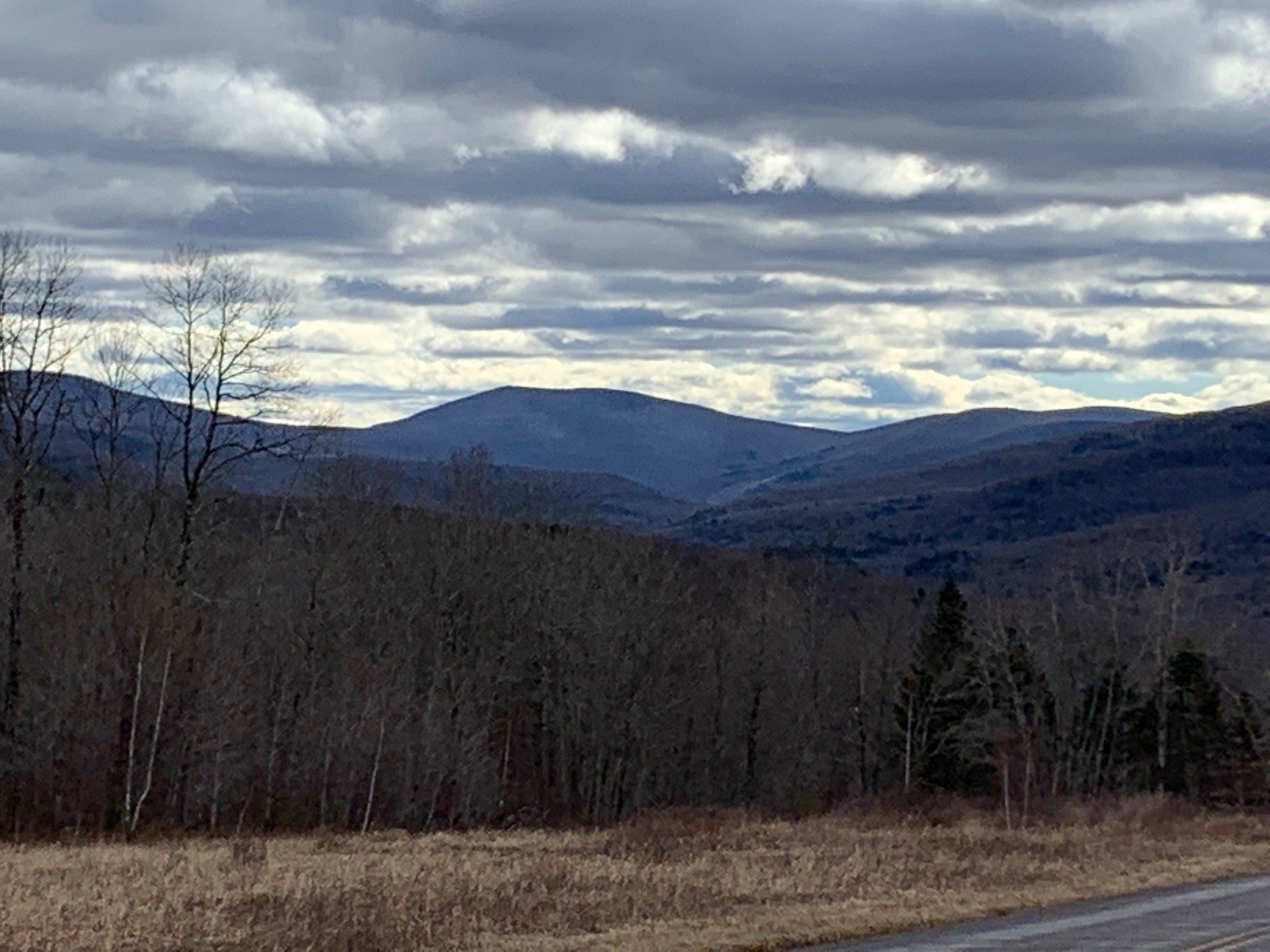
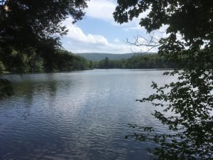
Hike the Trails at Frick Pond | Saturday, May 27, 2023 @ 9:45
 Join us for this lovely hike with moderate uphill climbs and streamcrossings with a varied woodlands display. Features a unique boardwalksection through an old pine forest. We'll visit Hodge Pond, too. Lots of wildflowers in Spring!
Hike pace to be a steady moderate! Some pretty views to stop and admire. Come join the fun day!Hike not for beginners. Please be in good health to attend hike followingCMC guidelines. Group size limited.Event Duration: 7.5 miles, 4 hoursLevel of Difficulty: ModerateLeader(s): Deanna FelicettaBring: good hiking shoes, lunch, snacks, bug spray, plenty to drink, map and compass (recommended).Registration required by May 25th. Register by contacting the leader. See below.Leave full name, reachable phone number and email to register.Group size is limited to 12, so register early.Dogs allowed: Yes, only with permission of event leaderAdditional Information: if any.Registration and Questions about this event can be directed to: felicetta.deanna@gmail.com or call 845-216 2021. NO TEXTING PLEASE! Leave name and number. Please contact leader if you need to cancel.Driving Directions:From Rt. 17 use Exit 96/Livingston Manor. Take Debruce Rd. 6 miles east to Mongaup Rd. Turn north onto Mongaup Rd. 2.5 miles to Beech Mountain Rd. Frick Pond P.A. is about .3 miles.From Rt. 28 in Big Indian turn south onto Oliverea/Frost Valley Rd. and go 19.3 miles to Round Pond Rd., about 1 mile north of Claryville. Follow Round Pond Rd./Willowemoc Rd. 11.6 miles to Mongaup Rd. Turn north onto Mongaup Rd. 2.5 miles to Beech Mountain Rd. Frick Pond P.A. is about 0.3 miles.GPS coordinates: 41.950982, -74.706940

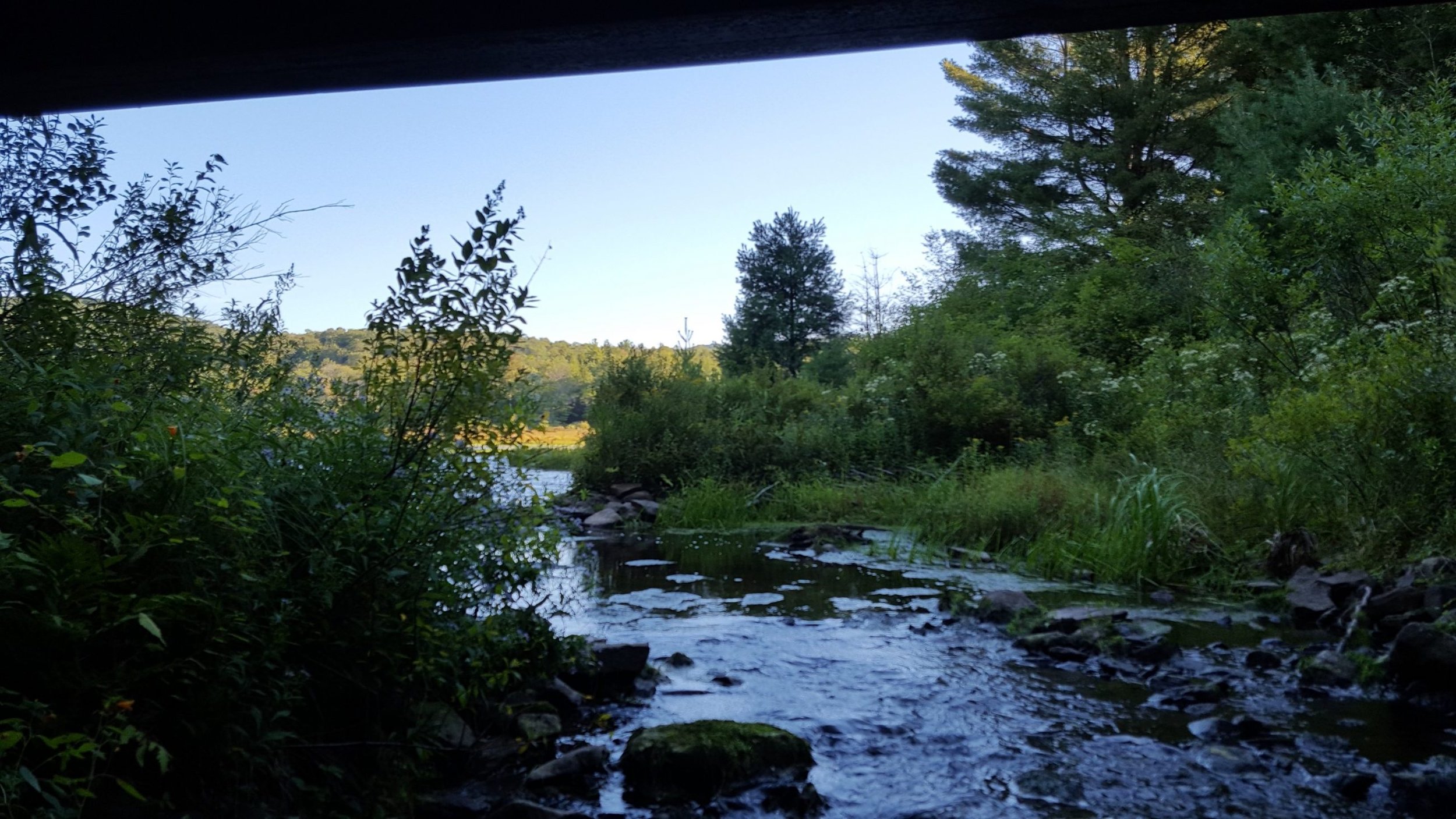
Hike the Huntersfield Creek Falls Trail – Saturday, 2/18/23 9:00 AM
Hike the Huntersfield Creek Falls Trail – Saturday, February 18, 9:00 AM Join Peter Manning, CMC Executive Director; Michelle Yost, Watershed Coordinator, Greene Co. SWCD; and Robert Titus, Geologist for a short hike on the Huntersfield Creek Falls Trail (HCFT) in Prattsville. Discussion will include how the trail was created, watershed protection partnerships, Catskills geology, connecting hamlets and trails, and the status of efforts to restore of Pratt Rock.This two-mile hike is rated easy to moderate and is expected to take 1.5 – 2 hours. Participants must bring any food or water they need, as well as (depending on the weather) winter gear, including microspikes or hiking crampons and/ or snowshoes. (See directions below.) To register, email Peter@catskillmountainclub.org by 6PM Friday February 17.Event Duration: 2 miles, 1.5 - 2 hoursLevel of Difficulty: Easy - ModerateLeader(s): Peter Manning, CMC; Michelle Yost, GCSWCDBring: Water, lunch/snacks, sturdy hiking boots, hiking crampons, snowshoes (as applicable)Registration required by 6PM 2/17/23 . Register by contacting the leader: Peter@catskillmountainclub.orgDogs allowed: NoAdditional Information: Rain/snow date: TBDDriving and Meeting Directions: Prattsville is located on State Route 23, 14 miles west of Windham and 5 miles east of Grand Gorge (connects with State Rte. 30). From State Route 23A Prattsville is 18 miles west of Hunter (connects with State Rte. 214). On-street parking is available along Main Street (Route 23) in Prattsville. The meeting and starting point of the hike is the HCFT trailhead, located one-quarter mile east of the Great American market on the same side Main Street. Walk along the sidewalk to its end point.GPS coordinates: 42.311911, -74.427813
First Day Hike to Kelly Hollow - Sunday 1/1/2022 10:00 AM
 First Day Hike to Kelly Hollow - Sunday 1/1/2022 10:00 AMKelly Hollow is one of the most beautiful short trails in the Catskills with rocky streams and waterfalls. It has a combination of coniferous and deciduous forests with a lovely abandoned beaver pond near a lean-to at the top. The trail is an easy to moderate loop of about 4 miles. Bring lunch and/or snacks to have at the lean-to (there is a privy nearby.)Event Duration: 4miles round trip, 3 hoursLevel of Difficulty: Easy-ModerateLeader(s): Howard RaabBring: good hiking shoes, lunch, snacks, micro-spikes, dress for cold weather, plenty to drink, map and compass (recommended),Registration required by 12/31/22 date. Register by contacting the leader. See below.Group size is limited to 12, so register early.Dogs allowed: Leashed or well-behaved dogs are welcome.Registration and Questions about this event can be directed to: howardjraab@gmail.comDriving Directions: The Kelly Hollow Trail is located on Millbrook Road in the town of Middletown, NYNJ Trail Conference map #142, F-5,6.
Directions to trail-head: 2.2 miles West of Margaretville on Rt.28 go left across from the Old Stone School house and then right on the NYC reservoir road (BWT10) for 3.7miles. Then left on Millbrook Road for 5.3 miles to the trail-head parking area on the right.
GPS coordinates: 42.079007, -74.649885
First Day Hike on Biscuit Brook Trail - Sunday 1/1/2023 9AM
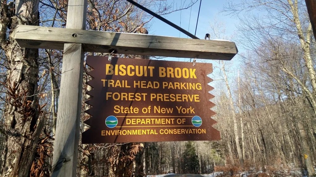 First Day Hike on Biscuit Brook Trail - Sunday 1/1/2023 9AMBiscuit Brook trail aka Pine HIll-West Branch trail (Blue) Trail begins on north side of County Rt.47 (From Kingston it takes 1hr. to the trailhead. Take Rte 28 West to Big Indian, turn Left on Rt.47 for 12.5 mls.) In 2 mls we reach the Lean-to on the left, moderate. continue for 2.5 mls. to the high point of trail near summit. moderate to difficult.Event Duration: 9 miles round trip, 7 hoursLevel of Difficulty: Moderate-DifficultLeader(s): Laura BattelaniBring: good hiking shoes, lunch, snacks, micro-spikes, plenty to drink, map and compass (recommended),Registration required by 12/31 date. Register by contacting the leader. See below.Group size is limited to 12, so register early.Dogs allowed: NoAdditional Information: if anyRegistration and Questions about this event can be directed to: bodyworx@catskill.netDriving Directions: From Kingston it takes 1hr. to the trailhead. Take Rte 28 West to Big Indian, turn Left on Rt.47 for 12.5 mls.GPS coordinates: 41.99155582496708, -74.48484007509846
Please make sure our email address is in your contacts list!

Today’s communications continue to rely heavily on emails. With increasing email use comes more filters to help sort incoming emails. Sometimes emails that have many recipients, like newsletters, may be sorted into bulk email, junk, or other non-primary folders.
To help ensure you continue receiving emails from us, please add info@catskillmountainclub.org to your contact list.If you find an email from info@catskillmountainclub.org in your spam or junk folder, your email provider likely includes the option to mark emails as “not junk.” The program will recognize the email address as a Safe Sender. This can also help ensure you get emails from this address in the future.While email programs vary in how to add new contacts to your list, it’s usually straightforward. For example, Outlook typically includes a “People” icon and clicking it changes your view to all your contacts. Clicking the “plus” sign enables contacts to be added. In Gmail, clicking on the icon with the nine dots arranged in a square (usually in the upper right) will open the drop-down menu that includes Contacts.Thank you.
First Day Hike to Panther Mountain - Sunday 1/1/23 9AM
 Join Peter Manning for a 6.5-mile out-and-back hike to the summit of Panther Mountain. In cooperation with NYSDEC's First Day Hikes, this outing is rated moderate to difficult and is expected to take 4-5 hours. The route has 1725’ of elevation gain with rocky terrain. Participants must bring food, water, and winter gear, including hiking crampons and snowshoes. (See directions below.) To register, email Peter@catskillmountainclub.org by 6PM Friday December, 30.Event Duration: 6.5 miles, 4-5 hoursLevel of Difficulty: Moderate - DifficultLeader(s): Peter ManningBring: Water, lunch/snacks, sturdy hiking boots, hiking crampons, snowshoes (as applicable)Registration required by 12/30/22 6PM. Register by contacting the leader. See below.Group size is limited to 12, so register early.Dogs allowed: NoAdditional Information: Rain/snow Date: Sunday, 1/2/2023Covid-19 Guidelines: Wear a mask while congregated in the parking lot or at other sites. Hike single file, following social distancing protocols. Avoid carpooling except with members of your household. Use your own pen when signing in, or use hand sanitizer. Note: As vaccination rates rise, risks decrease. We will phase out these guidelines when rates improve significantly. In the meantime, please protect others and yourself by following these simple, CDC endorsed guidelines.Registration and Questions about this event can be directed to: Peter@catskillmountainclub.orgDriving Directions: To reach the Giant Ledge Parking Area (beginning and end of hike), take State Route 28 to Big Indian and turn south on Ulster County Route 47. Take Route 47 7.3 miles to the sign for the parking area on right.GPS coordinates: 42.026301, -74.403551
Catskill Visitor Center now renting hiking traction aids
Safety First: Catskill Visitor Center is Renting Crampons
Winter hiking in the Catskills requires preparedness. While the ground outside your door may seem fine for regular hiking footwear, the trails could tell a different story. You can buy or rent crampons from the Catskills Visitor Center.
CVC winter hours (Dec - March) / Fri, Sat, Sun, Mon / 9:30am - 4pm
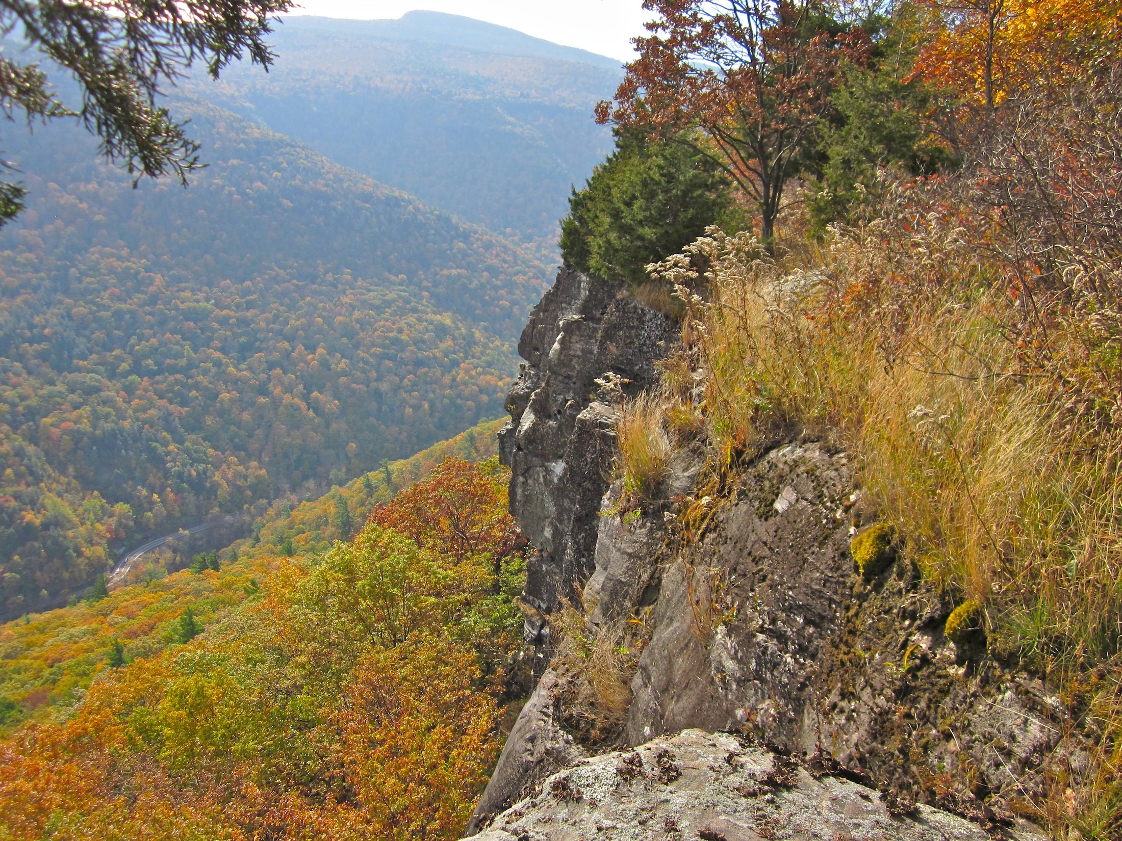
Overlook Mountain | Saturday, 11/26/2022, 9:30 AM
 Overlook Mountain | Saturday, 11/26/2022, 9:30 AMThis is about a 6.5-mile hike from the Meads Meadow Trailhead, using the Overlook Mountain connector to the yellow, then blue to the main Overlook Mountain trail. From there, the trail climbs steadily to the top of Overlook Mountain following an old gravel road to ruins of an old hotel that once transported guests in the late 19th century to the Overlook Mountain House. There are great views from the cliffs on Overlook of the Hudson Valley and the Catskill High Peaks as well as from the top of the fire tower. We’ll break for lunch at another viewpoint where it’s lesser known. Event Duration: 6.5 miles, 4-5 hoursLevel of Difficulty: ModerateLeader(s): Siu S YuenBring: bug spray, map and compass (recommended), about 2 liters of water, lunch/snacks, sturdy hiking boots and traction in case of snow/ice.Registration required by 11/25/22 date. Register by contacting the leader. See below.Group size is limited to 12, so register early.Dogs allowed: NoAdditional Information: Rain/snow Date: Sunday, 11/27/2022Covid-19 Guidelines: Wear a mask while congregated in the parking lot or at other sites. Hike single file, following social distancing protocols. Avoid carpooling except with members of your household. Use your own pen when signing in, or use hand sanitizer. Note: As vaccination rates rise, risks decrease. We will phase out these guidelines when rates improve significantly. In the meantime, please protect others and yourself by following these simple, CDC endorsed guidelines.Registration and Questions about this event can be directed to: ssyuen@msn.comDriving Directions: Take RT-28W from Thruway, Exit 19 in Kingston for 6.4 miles, turn right onto NY-375 / State Route 375 (Woodstock), turn left onto NY-212 / Mill Hill Rd for .05 miles, turn right onto Rock City Rd / County Hwy-33 for .06 miles, keep straight onto Meads Mountain Rd for 2 miles where name changes to Macdaniel Rd for the next 0.5 miles and the parking area is on your right.GPS coordinates: 42.076422,-74.129087
Panther via Fox Hollow, Sunday, 8/14/2022, 8:30am
Panther via Fox Hollow, Sunday, 8/14/2022, 8:30am
 This is a 9-mile out and back hike to the summit of Panther (3,720 ft.). I’d done Panther 8 times from the very popular route, from Route 47, but I’ve never summitted Panther from this direction. The trail isn’t very well used, is longer, and the route is strenuous even for experienced hikers. We’ll follow the Giant Ledge – Panther trail (blue) where the trail ascends gradually with a few rock scrambles that do keep things interesting. We’ll approach several false peaks before we’ll arrive at the actual summit of Panther. We’ll break for lunch after the summit of Panther, retracing our steps to a viewpoint about 5 minutes away. Event Duration: 9 miles, 7 hoursLevel of Difficulty: Moderate-DifficultLeader(s): Siu S YuenBring: good hiking shoes, lunch, snacks, bug spray, plenty to drink, map and compass (recommended),Registration required by 8/12/2022 . Register by contacting the leader. See below.Group size is limited to 12, so register early.Dogs allowed: NoAdditional Information: if anyCovid-19 Guidelines: Wear a mask while congregated in the parking lot or at other sites. Hike single file, following social distancing protocols. Avoid carpooling except with members of your household. Use your own pen when signing in, or use hand sanitizer. Note: As vaccination rates rise, risks decrease. We will phase out these guidelines when rates improve significantly. In the meantime, please protect others and yourself by following these simple, CDC endorsed guidelines.Registration and Questions about this event can be directed to: ssyuen@msn.comDriving Directions: From Exit 19 in Kingston, Take RT-28W from Thruway in Kingston for 27.1 miles, turn left onto Fox Hollow Road for 1.5 miles to the trailhead parking area. GPS coordinates: N 42.31259 W 74.19040
Trail Maintenance on the Dry Brook Ridge and German Hollow Trails | Saturday, May 21, 2022 @10AM
 Follow Laura Battelani, CMC Board Member and David Lucas, volunteers for NY/NJ Trail Conference as they maintain their adopted trails. Join us on our Spring Trail Maintenance Hike on Dry Brook Ridge in Margaretville New York. We will drive to the Hill St. trail and climb approximately 1500 feet in a moderate climb and do light work clearing the trail and making sure things are tidy on Dry Brook Ridge. We'll hike Pakatakan Mountain and follow the ridge, passing by a 700 years old bog, to arrive to a beautiful lookout of the Pepacton Reservoir from almost 3500 ft. of altitude. We will relax and have mid-day lunch at the overlook, with beautiful western views of the Western Catskills.
Event Duration: 6 miles, 6 hoursLevel of Difficulty: Moderate-DifficultLeader(s): Laura Battelani and David LucasBring: Pack lots of water and your lunch and snacks. Wear comfortable layers. Bring a hat and bug spray and rain gear if weather is changeable. Wear sturdy hiking boots/shoes. Bring hand tools, clippers, loppers and/or folding saws if you have them, and gloves and eye protection, if you would like to help with clipping, light sawing, weed whacking etc..Registration required by May 20th. Register by contacting the leader. See below.Group size is limited to 12, so register early.Dogs allowed: NoRegistration and Questions about this event can be directed to: Laura Battelani at bodyworx@catskill.net or (845) 985-0169.Driving Directions: On Route 28, 40 miles west of Kingston, Village of Margaretville. Half mile after the blinking light at Bridge St., turn right at the intersection with Fair St. Meeting is at the car wash on the right. We will shuttle to the trailheads from here.
GPS coordinates: 42°08’40.6″N 74°39’09.7″W / 42.144613, -74.652681
Cycle the Catskill Scenic Trail on Earth Day, April 22, 9:00 AM
C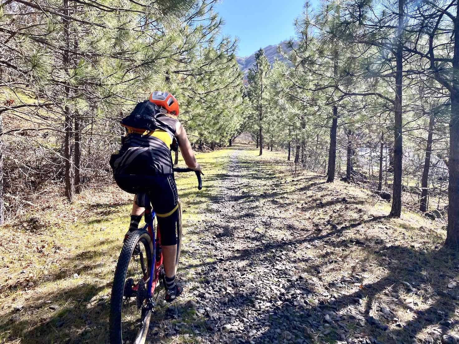 ycle the Catskill Scenic Trail on Earth Day, April 22, 9:00 AMTake a round trip ride, from Bloomville to Stamford (and back) along the former Ulster & Delaware Railroad corridor as it follows the West Branch of the Delaware River. This is a 25-mile ride along an unpaved surface and is rated Moderate – Difficult. Mountain bikes are strongly encouraged, although hybrid bicycles are also acceptable. Please, no road bikes. The ride begins in Bloomville at the Catskill Scenic Trail’s westernmost access point. Marked with a sign, the parking area is on south side of State Route 10 just north of the intersection with River Road. We will begin at 9:00 AM and break for lunch at Stamford.Event Duration: 25 miles, 3-4 HoursLevel of Difficulty: Moderate-DifficultLeader(s): Peter ManningBring: Mountain bikes are strongly encouraged, although hybrid bicycles are also acceptable. Please, no road bikes. Please bring your own food and beverages.Registration required by 6 PM April 21st. Register by contacting the leader. See below.Dogs allowed: Only if they run fast or have their own bikes. (Just kidding - no pets please)Covid-19 Guidelines: Please protect others and yourself by following CDC endorsed guidelines.Registration and Questions about this event can be directed to: Peter Manning pqm7364@hotmail.com by 6:00 PM on April 21. Rain date is April 23, 9:00 AM.If you have to cancel please notify the hike leader.Driving Directions: The ride begins in Bloomville at the Catskill Scenic Trail’s westernmost access point. Marked with a sign, the parking area is on south side of State Route 10 just north of the intersection with River Road. The parking area is 8.1 miles north of Delhi and 12.3 miles south of Stamford.GPS Coordinates: -74.804 42.332
Spring Ephemeral Walk | May 7th, 2022 -- Sorry, registration is closed, this event is full
Spring Ephemeral Walk - Saturday, May 7th, 2022 - 11 AM
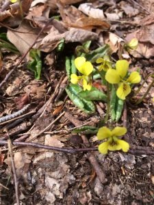 This a chance to find and identify the beautiful Spring ephemeral wildflowers which are so named because they appear in early spring when they flower and fruit and then die back, all in a short period before the trees have had a chance to leaf out. Most hikers never see these flowers because they wait for late spring or summer to get into the woods. We will look for Trillium, Spring beauties, Trout Lily, Hepatica, Violets, Squirrel Corn, Dutchman's Breeches, Jack-In-The-Pulpit and many others. We may also find some early mushrooms and ramps.
Kelly Hollow is one of the most beautiful short trails in the Catskills with rocky streams and waterfalls. It has a combination of coniferous and deciduous forests with a lovely abandoned beaver pond near a lean-to at the top. The trail is an easy to moderate loop of about 4 miles. Bring lunch and/or snacks to have at the lean-to (there is a privy nearby.)
We will continue to follow social distancing protocols, with masks on in the parking lot and optional on the trail. Please maintain safe distancing at all times.
Event Duration: About 3 hours
Level of Difficulty: Easy-Moderate
Leader: Howard Raab
Bring: hiking shoes, snacks/lunch, bug repellant, and something to drink.
Registration required by - this event is full.
Group size is limited to 12. As it is a very popular event, I would suggest that you register early.
Leashed or well-behaved dogs are welcome.
Additional Information: In case of steady rain the hike will be moved to Sunday, May 2nd . If in doubt, call before 10:00 am on Saturday.
Covid-19 Guidelines: Wear a mask while congregated in the parking lot or at other sites. Hike single file, following social distancing protocols. Avoid carpooling except with members of your household. Use your own pen when signing in, or use hand sanitizer. Note: As vaccination rates rise, risks decrease. We will phase out these guidelines when rates improve significantly. In the meantime, please protect others and yourself by following these simple, CDC endorsed guidelines.
Questions about this event can be directed to: howardjraab@gmail.com, or (845) 586-3112.
We will meet at the trail-head at 11:00 am.
Directions:
The Kelly Hollow Trail is located on Millbrook Road in the town of Middletown, NYNJ Trail Conference map #142, F-5,6.
Directions to trail-head: 2.2 miles West of Margaretville on Rt.28 go left across from the Old Stone School house and then right on the NYC reservoir road (BWT10) for 3.7miles. Then left on Millbrook Road for 5.3 miles to the trail-head parking area on the right.
GPS: 42.079007, -74.649885
Cycle along the Pepacton Reservoir | Saturday, May 14, 2022 @ 9 AM Postponed - Date TBD
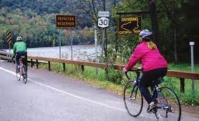 Cycle along the Pepacton ReservoirEnjoy a round-trip ride of 29 miles from Arkville to Shavertown Bridge (Route 30 crossing of the Pepacton) and back. This is a road bicycle ride and is rated Moderate – Difficult. Please, no mountain or hybrid bikes. The ride begins at the Catskill Recreation Center in Arkville, on the Arkville Cross Road (Co. Hwy. 38). We will begin at 9:00 AM and break at Shavertown, as needed.Event Duration: 29 miles, 2.5 - 3.5 HoursLevel of Difficulty: Moderate-DifficultLeader(s): Peter ManningBring: Please, no mountain or hybrid bikes. Please bring your own food and beverages.Registration required by 6 PM May 13th. Register by contacting the leader. See below.Dogs allowed: Only if they run fast or have their own bikes. (Just kidding - no pets please)Covid-19 Guidelines: Please protect others and yourself by following CDC endorsed guidelines.Registration and Questions about this event can be directed to: Peter Manning pqm7364@hotmail.com by 6:00 PM on May 13. Rain date is May 15, 9:00 AM.If you have to cancel please notify the event leader.Driving Directions: The ride begins at the Catskill Recreation Center (CRC) in Arkville, on Co. Hwy. 38 (the Arkville Cross Road). From State Route 28 north, enter Arkville 6.5 miles west of Highmount/ Belleayre Ski Center; proceed one-quarter of a mile and turn right on Co. Hwy. 38 – the CRC is on the left in three-quarters of a mile. From State Route 28 south, turn left onto Co. Hwy. 38 (1.4 miles west of Margaretville/ Bridge St.); the CRC is on the left in three-quarters of a mile. From State Route 30 South, turn left onto Co. Hwy. 38, 10.2 miles south of the hamlet of Roxbury; the CRC is located on the right in one-third of a mile.GPS Coordinates: -74.620 42.157
Hike to North Point | Saturday, June 4th, 2022 @ 10 AM
Hike to North Point from North-South Lake - Saturday, June 4th, 2022 – 10 AM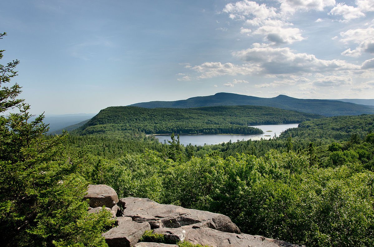 Hello CMC hikers!This is one of my favorite hikes in the Catskills. It’s a “greatest hits” of well-known viewpoints and attractions, such as Artists Rock, Sunset Rock, Newmans Ledge, Badmans Cave, North Point, Ashley Falls, and more.The hike is a loop of 5.15 miles total, with 1,100 feet of ascent. Most of the hike is easy-moderate with several small sections of moderate+ steepness and rockiness. This is a great hike for beginners looking to explore trail hiking without lots of elevation or technical sections, all while seeing some fantastic views and Catskill attractions. We will hike to North Point (the halfway point) to have lunch, then head back down a different route to the parking lot.Here’s the route map of the hike: www.gaiagps.com/map/?loc=13.1/
Western Catskills Exploration: Neversink-Hardenburg/ Finger Lakes Trail | Saturday, June 11, 2022 @ 9 AM
 Come explore this gentle section of the long distance Finger Lakes trail with many features including streams, ponds, beaver meadows wildflowers and mountain vistas. For more information about the location, please email me. I will be camping at nearby Little Pond campground from Friday to Sunday. If you want to camp you can book a site through ReserveAmerica.com. Please register and contact the leader for meeting time and place.Event Duration: 7 miles, 5 hoursLevel of Difficulty: Easy-ModerateLeader(s): Sharon KleinBring: good hiking shoes, lunch, snacks, bug spray, plenty to drink, map and compass (recommended),Registration required by June 7. Register by contacting the leader. See below.Group size is limited to 15, so register early.Dogs allowed: Yes, leashed onlyAdditional Information: If you want to camp you can book a site through ReserveAmerica.com. Please register and contact the leader for meeting time and place.Covid-19 Guidelines: Wear a mask while congregated in the parking lot or at other sites. Hike single file, following social distancing protocols. Avoid carpooling except with members of your household. Use your own pen when signing in, or use hand sanitizer. Note: As vaccination rates rise, risks decrease. We will phase out these guidelines when rates improve significantly. In the meantime, please protect others and yourself by following these simple, CDC endorsed guidelines.Registration and Questions about this event can be directed to: Sharon Klein CatsNGunks@gmail.comDriving Directions: Contact Sharon Klein CatsNGunks@gmail.com
Smith Pond Trail Temporarily Closed
 The Smith Pond Trail is closed until further notice. Due to a construction project that will address drainage issues near Rte. 28, the trailhead to the Smith Pond Trail is being used as a staging area. As soon as the work allows, the trail will be reopened. For those who are working on the CMC Hiking Trails Challenge, the requirement to hike the Smith Pond Trail is temporarily suspended. You may submit applications without hiking this trail. After we announce its reopening, It will be required hiking again for new applicants. Thanks for your cooperation.
Welcome to the Catskill Mountain Club
With similar dedication, we act as stewards of our natural resources and as maintainers of the trails and facilities that make access to them readily available. We work and play throughout the Catskill region, both inside and out of the park boundary. And we offer educational events to familiarize our members and guests with the natural and human histories of our region and with the issues that confront us as we seek to preserve and protect our natural resources and environment.We encourage you to look at the features available on this website and to then join with us in celebrating the sublime mountains, streams, reservoirs, and lakes that provide numerous opportunities to get out into nature. You will find a wealth of resources for your use to learn about what the Catskills have to offer and to plan a visit. We look forward to having you participate in our events.And while you're at it, please consider joining the CMC. Your support will help us do even more as we work to provide activities for your enjoyment and to help protect and preserve the Catskills, America's first wilderness.Please remember to always follow Leave No Trace Principles when recreating in in our wild and conserved places wherever you go!
Groomed Cross Country Trails at Delhi Golf Course
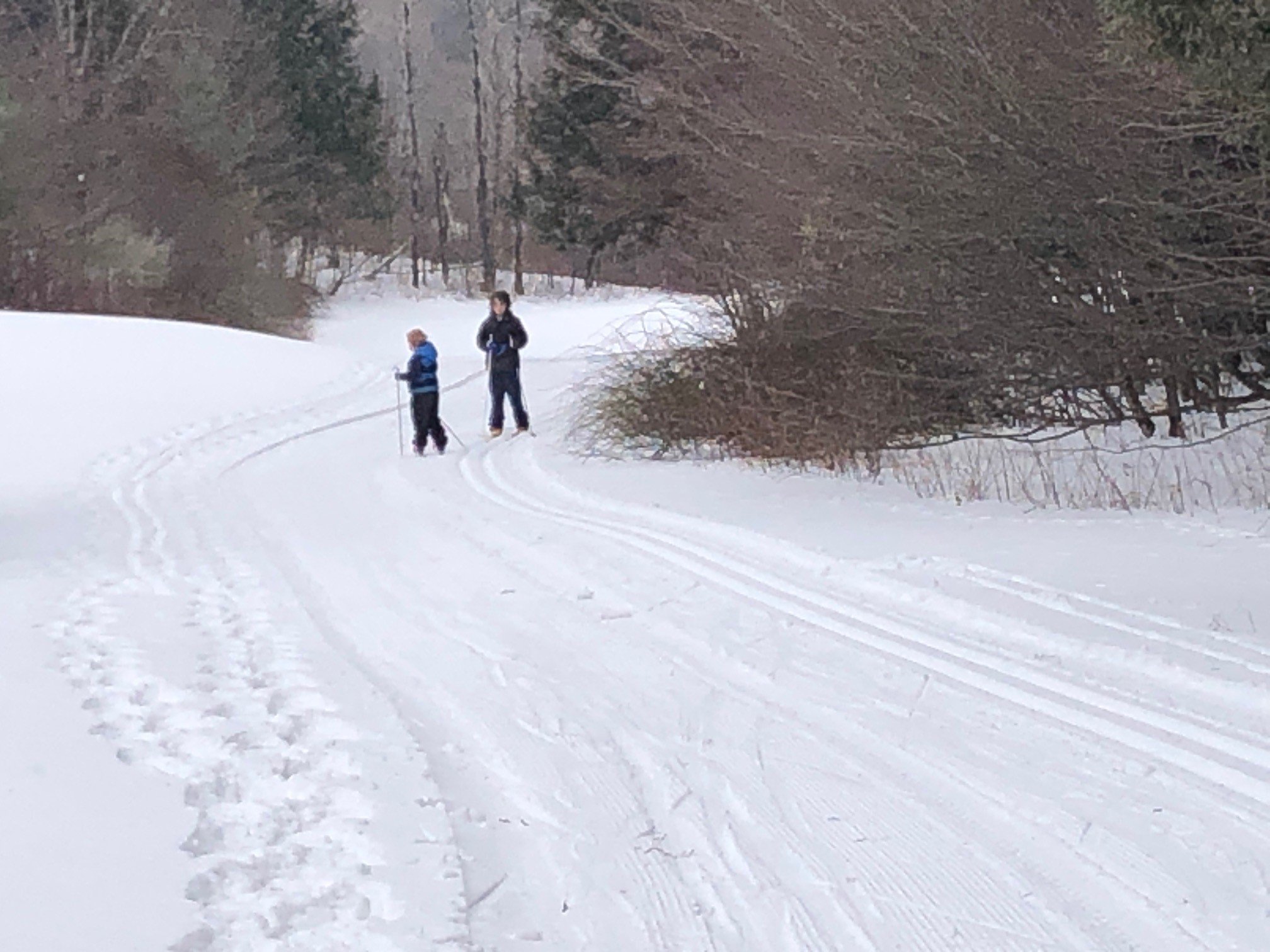 The enjoyment of classic cross-country skiing is greatly enhanced by skiing on a groomed surface. These conditions are made possible by proper grooming equipment to prepare the snow. Fortunately, SUNY Delhi College has acquired a specialized utility vehicle with snow treads and a classic track setter. The result is a quality trail system at the college’s Golf Course, which is open to the public at no cost. David DeForest, Assistant Professor in Applied Sciences, is the leading force in maintaining the trails each winter. The trails begin at the Bluestone Pub and Restaurant at the foot of Scotch Mountain Road (off Arbor Hill Road). There are about four miles of trails with easy and intermediate loops. They are situated in a peaceful setting that includes two crossings of the Little Delaware River and great views of Bell Hill. Complete grooming of the trail system takes about three hours, while re-grooming is also conducted to keep the surface and tracks clean and firm. This promotes the skiing experience because the recessed tracks allow the skier to look around, enjoy the scenery, and maintain good form, instead of trudging through snow.read more