
News
Sample Newsletter
Click on the image below to link to a sample newsletter.

Hike to Dry Brook Ridge, September 9, 9AM

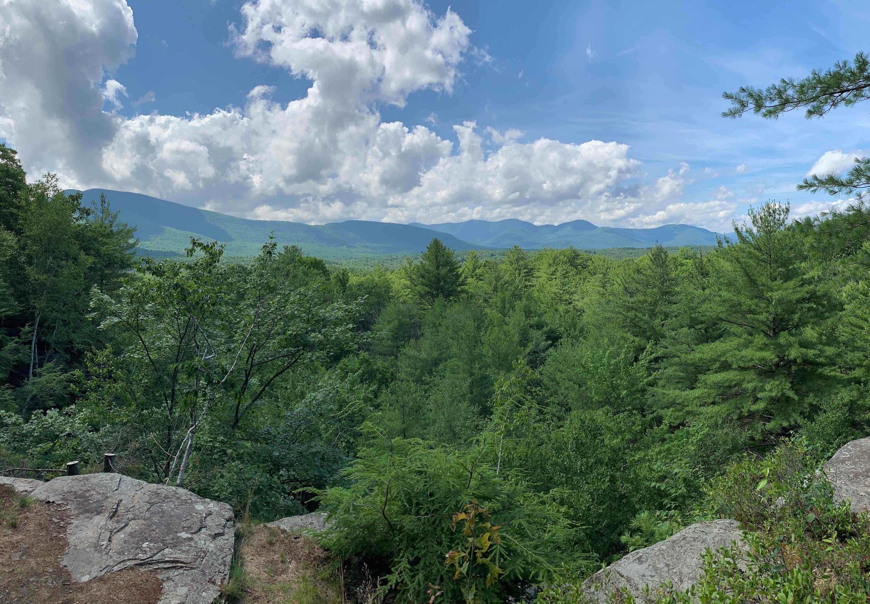
Enjoy a hike in the Western Catskills with this 7-8 mile out-and-back, moderate-to-difficult hike to Dry Brook Ridge, which is a requirement for the Catskill Mountain Club's grid. The hike is not too strenuous (about 1500’ elevation gain), and it has a handful of very nice viewpoints along the ridge. It's a pretty hike in the woods to enjoy nature. There's a short herd path (a little bushwhack) that leads to the summit. We'll either eat lunch near the summit or retrace our steps to enjoy our lunch at a better viewpoint.To register for this hike, please contact Siu S. Yuen via email at ssyuen@msn.com by 6PM on September 8. Participants need to bring at least two liters of water, lunch, snacks, sunscreen, bug spray, and most importantly, sturdy hiking boots. Dogs are not permitted on this hike. The rain date is September 10.We will meet at the Hill Road Trailhead parking area and be ready to go at 9AM. To reach the Hill Road parking area from the east, take State Route 28/30 1.9 mi. miles west from Fair St. Margaretville and turn left, following the signs for the Hill Road Trailhead. From the west, take State Route 28/30 east 1.2 miles from the junction of State Routes 28 & 30 at Dunraven and turn right, then following the signs for the Hill Road Trailhead. The GPS Coordinates for the Hill Road Trailhead are 42.116056, -74.646553.
Through Hike and Clear Brush on the Plattekill State Forest Road, 9 AM Saturday, August 5
Join a group of volunteers who will complete the reopening of the Plattekill State Forest Road in the towns of Bovina and Middl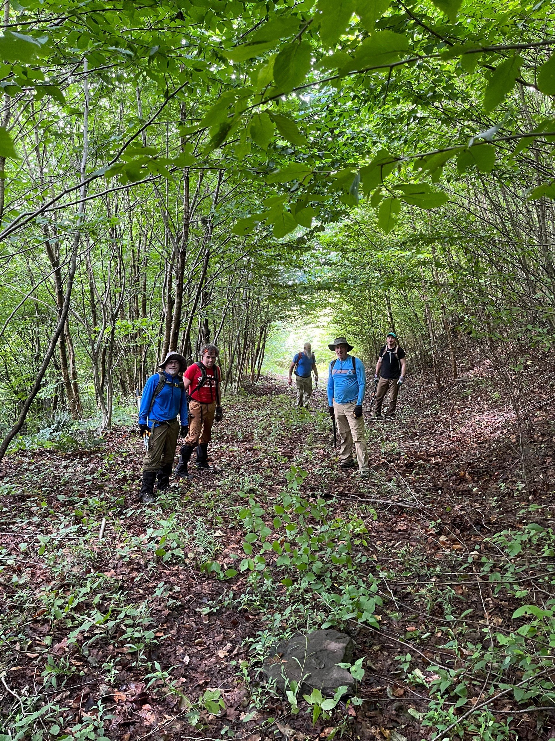 etown This is a 5.5 mile point-to-point hike that will include brush trimming and limb lopping. Carpooling is necessary. Join with your friends to preplace a vehicle in the town of Middleton, then drive back to Bovina (11 miles) to begin the hike. Or, carpool with existing volunteers, space allowing.Participants should bring a pair of loppers and a handsaw, as well as lunch, snacks, sturdy boots, insect repellent, and plenty of water. The hike is rated moderate-difficult and is expected to take six hours. Dogs are not permitted on this hike. For more information, including directions and carpooling, contact Peter Manning at Peter@catskillmountainclub.org by 5PM Friday August 4.
Hike Black Dome and Thomas Cole, Saturday, August 12 8:30 AM
Join Siu S Yuen for this difficult 6.5-mile, out-and-back hike to Black Dome (3,980 ft.) and Thomas Cole (3,950 ft.). We'll take the Black  Dome Range trail (red), cross the Batavia Kill, and ascend steeply to the ridgeline with viewpoints. We'll continue on the trail over Black Dome and on to the wooded summit of Thomas Cole. After a pause at Thomas Cole, we'll retrace our steps and break at the viewpoint looking south from Black Dome. From here, we’ll head down the trail and back to our cars.The hike is expected to take five hours. Participants should bring lunch, at least 2 liters of water, snacks, maybe sunscreen, bug spray, and most importantly, sturdy hiking boots. Dogs are not permitted on this hike. Participants must register by 6 p.m. on Friday, 8/11/2023 by contacting Siu S Yuen at ssyuen@msn.com The rain date is Sunday, August 13.DirectionsFrom (Ext 20) in Saugerties, take 32 North for 6 miles, keep straight onto NY-32A / Route 32A for 1.3 miles, keep right to stay on NY-32A / Route 32A for 0.6 miles, bear left onto NY-23A / Route 23A for 5.5 miles, turn right onto County Route 25 / County Hwy-25 for 2.7 miles, bear right onto County Route 23C and stay on it for 4 miles, turn right onto Maplecrest Rd / County Hwy-40 for 1.9 miles, turn right onto County Hwy-56 (Big Hollow Rd) for 4.3 miles until the end and park in lot at the end. Meeting location GPS coordinates: N42.2886 W74.1143.From Exit 20 (Saugerties) NYS Thruway, take NY 32 north for six miles and keep straight onto NY-32A. Take NY-32A for 0.6 miles, bear left onto NY-23A. Take Route 23A for 5.5 miles, turn right onto County Hwy 25. Take County Hwy-25 for 2.7 miles, bear right onto County Route 23C and stay on it for four miles. Turn right onto Maplecrest Rd. (County Hwy 40), go 1.9 miles, then turn right onto County Hwy 56. Take County Hwy 56 (Big Hollow Road) for 4.3 miles until the end. Park in lot at the end of the road. Meeting location GPS coordinates: N42.2886 W74.1143.From NY-23 in Windham, take 23 east to NY-296; turn right on 296 and take 1.5 miles and stay straight (296 goes left) onto Co. Hwy 40 (Maplecrest Rd.) and continue two miles to Maplecrest and turn left onto Co. Hwy 56 (Big Hollow Road) for 4.3 miles until the end. Park in lot at the end of the road. Meeting location GPS coordinates: N42.2886 W74.1143.From NY-23 in East Windham, take 23 west to Co. Hwy 65 and turn left onto 65A. Take 65A, this merges with Co. Hwy. 40, and continue three miles to Maplecrest. turn left onto Co. Hwy 56 (Big Hollow Road) for 4.3 miles until the end. Park in lot at the end of the road. Meeting location GPS coordinates: N42.2886 W74.1143.

CMC Mini-Golf Fundraiser June 30, 5-7 PM
Looking for a laid-back event to kick off the July 4 weekend and support CMC? Then please join us for our Mini-Golf Fundraiser on June 30, 5-7 PM at Putt Putt Van Winkle. Enjoy a one-of-a-kind mini-golf experience with food, drink, and prizes in the scenic town of Bovina.Your participation in this event will help support CMC’s free outdoor recreation activities, trail construction and  maintenance programs, hiking challenges, advocacy for sustainable use of the Catskill Park and region, and our educational outreach programs like Views from the Watershed and Speak to the Earth.Cost of the event is $50 per person. Rain or shine (tents on site). REGISTER HEREPutt Putt Van Winkle is in the Western Catskills. From Andes, take Route 28 north 4.7 miles and to County Highway 6. Turn right and go 4.7 miles. Putt Putt Van Winkle is on the right. From Delhi (traffic light at Rtes. 10 and 28) take Route 28 south 7.5 miles to County Highway 6. Turn left and go 4.7 miles. Putt Putt Van Winkle is on the right. From Stamford (junction of Routes 23 and 10), take Route 10 south and go 8.1 miles to South Kortright. Turn left at blue and yellow sign for County Highway 18. Go over bridge and turn right at stop sign. Continue 1.2 miles to County Highway 5 and turn left. Continue on Highway 5 for 1.3 miles and bear left onto New Road. Take New Road 3.5 miles to the stop sign at the end. Putt Putt Van Winkle is across the road.For more information, please contact Peter@catskillmountainclub.org
POSTPONED TO 7/23 Hike to Slide Mountain, the Catskills’ Highest Peak, NOW July 23, 9 AM
This 11.2-mile hike, beginning at the Denning Trailhead, offers a chance to take a lesser-traveled route to Slide Mountain. This outing will include 2100’ of elevation gain and is expected to take 8-10 hours. Though rated difficult, the hike will follow marked trails and pass thr ough a variety of forest types and trailside environments and include some open views.Hikers must register for this event by contacting leader Al Purdy, either by email Albertpurdy1@aol.com or phone (845) 489-2332 by July 21. Space is limited.Participants need to bring lunch, as well as a lot of water, headlamp or flashlight, rain gear, sunscreen, and insect repellent. The ability to filter water would be a plus. Dogs are not permitted. Heavy rain or severe thunderstorms cancels the hike.From the NYS Thruway Exit 19 Kingston, bear right onto State Route 28 West and go 30 miles to Big Indian. Turn left at Big Indian onto Ulster County Route 47 (Oliverea Road) and go south for 20.3 miles. Turn left onto Sullivan County Route 19 (Denning Road); go through the hamlet of Claryville, pass back into Ulster County, and follow this road for 7.7 to the DEC parking area at the end of the road. From Margaretville, turn left onto State Route 28 from Bridge Street and follow for 12.3 miles. Turn right onto Ulster County Route 47 (Oliverea Road), follow for 20.3 miles. Turn left onto Sullivan County Route 19 (Denning Road), pass back into Ulster County, and follow this road for 7.7 to the DEC parking area at the end of the road. GPS Coordinates: N41 57.9545 w74 27.144
Hike Hunter and Southwest Hunter Mountains – July 22, 8:30 AM
This is a 10-mile strenuous loop hike to SW Hunter (3,750 ft.) and Hunter (4,040 ft.), which is the second highest of the Catskills High Peaks. We'll take the Diamond Notch Trail (blue) to Devil's Path (red) to where we'll have our first view at Geiger's Point. We'll take a herd path to SW Hunter where we'll retrace our steps for a bit, and then we'll continue via the Devil's Path to the summit of Hunter. The fire tower offers outstanding views and there is a nearby viewpoint looking out over Southwest Hunter and beyond. Continuing from Hunter on the Spruceton Trail (blue), we’ll make a short stop at John Robb lean-to and view before we loop out to our cars. 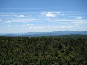
Participants need to bring lunch, at least 2 liters of water, snacks, maybe sunscreen, bug spray, sturdy hiking boots. Pre-registration is required by 6 PM July 21. Please contact leader Siu S Yuen via email ssyuen@msn.com This hike is expected to take seven-eight hours. Dogs are not permitted. The bad weather date is Sunday, July 23.From the traffic circle at Kingston/ Exit 19 NYS Thruway, take NY-28 west for 27.6 miles, turn right onto NY-42 and go 7.3 miles, then turn right onto Spruceton Road/County Highway 6 and go 6.7 miles and park at the first lot on your left (the lot with the horse ramp). (The NY-28/ 42 junction is 3.1 miles east of Big Indian.)From NY-23A go the junction with NY-42 at Lexington; take 42 south for 4.1 miles and turn left on Spruceton Road/County Highway 6. Go 6.7 miles and park at the first lot on your left (the lot with the horse ramp). (The NY-23A/ 42 junction is 6.3 miles east of the junction of NY-23A/ 23 in Prattsville and 7.7 miles west of the junction of NY-23A/ 296 in the village of Hunter.)
Hike Arizona and Blackhead Mountains, August 13 9AM
Enjoy this 9.5-mile hike, beginning at the Stork’s Nest Parking area, climbing Dutcher Notch, and reaching the Arizona (3413’) and Blackhead Mountain (3940’) summits. This scenic trail hike is rated as difficult, includes 2728’ of elevation gain, and will take six-to-eight hours. Participants need to bring lunch, a lot of water, headlamp or flashlight, rain gear, sunscreen, and insect repellent. Participants must pre-register by August 11 by contacting leader Al Purdy via email Albertpurdy1@aol.com or by phone (845) 489-2332. Dogs are not permitted; and severe weather cancels the hike. From NYS Thruway Exit 21 Catskill make a left at traffic light, go approximately 0.4 miles and turn right on Route 23 West. Go 5.2 miles and turn left onto Silver Spur Rd. Take Silver Spur Rd. for 1.3 miles then turn right and an immediate left onto the Mountain Ave. Take Mountain Ave. .75 and stay left on Co. Rte. 39. Take 39 1.25 miles to stop sign. Continue straight across intersection onto Maple Lawn Road for 1.25 miles. Turn left and make first right onto Storks Nest Rd. Continue to end of Storks Nest Road and parking area is on the left. GPS coordinates of trailhead: 42.252398, -74.053720From Windham (at the junction of State Route 23 and County Route 21), take Route 23 East 11.9 miles and turn right onto Hearts Content Road (Co. Rte. 31). Take Rte. 31 for 3.5 miles and turn right onto Maple Lawn Rd. Take Maple Lawn Rd. for 1.25 miles. Turn left and make first right onto Storks Nest Rd. Continue to end of Storks Nest Road and parking area is on the left. GPS coordinates of trailhead: 42.252398, -74.053720
Dry Brook Ridge & German Hollow Trail Maintenance, Sunday, June 4 10:00 AM
Join Laura Battelani, CMC Board Member, and David Lucas, NY/NJ Trail Conference volunteer as they maintain their adopted trails. 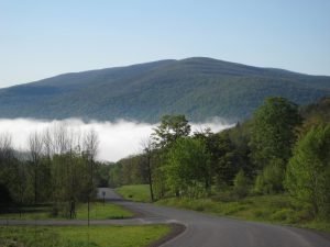 After meeting at the car wash in Margaretville, we will drive to the Hill Rd. Trailhead and climb approximately 1500 feet moderately and do light trail clearing, making sure things are tidy on Dry Brook Ridge. We'll then hike the ridge, passing by a 700-year-old bog, and arrive at a beautiful lookout of the Pepacton Reservoir from almost 3500 ft. of elevation. We will relax here and have midday lunch, with beautiful western views of the Western Catskills. In the afternoon, we will return on the German Hollow Trail, maintaining along the way. Pack lots of water and your lunch and snacks. Wear comfortable layers. Bring a hat, bug spray, and rain gear.Event Duration: 6 miles, 7 hoursLevel of Difficulty: Moderate-DifficultLeader: Laura Battelani, CMCBring: Water, lunch/snacks, sturdy hiking boots, rain gear. Wear comfortable layers. If you also want to help with the cleaning of the trail, bring hand clippers, loppers, and a foldable saw if you have them, and gloves and eye protection.Registration required by 6/3/23. Register by contacting the leader: bodyworx@catskill.net or (845) 586-3101Dogs allowed: No, please.Additional Information: Rain date: TBDDriving and Meeting Directions: On Route 28, go west 43 miles from the traffic circle at the NYS Thruway Kingston to the Village of Margaretville. Go past the first right turn to Margaretville (with the blinking light) and turn right at next, Fair St. intersection. The meeting place is at the car wash on Fair St. From Route 28 west, Fair St. is the first left turn to Margaretville.GPS coordinates: 42.144367, -74.652100
Hike to Windham High Peak – Sunday, June 11 9:00 AM
Join Al Purdy on this 7.5-mile round-trip hike to this 3524’ mountain in the northeast Catskills. This is a moderate-difficult trail hike that will take approximately six hours, beginning and ending at the Escarpment Trail Parking Area on Route 23 in the town of Windham. Participants need to bring lunch, 2-3 liters of water, and insect repellent. 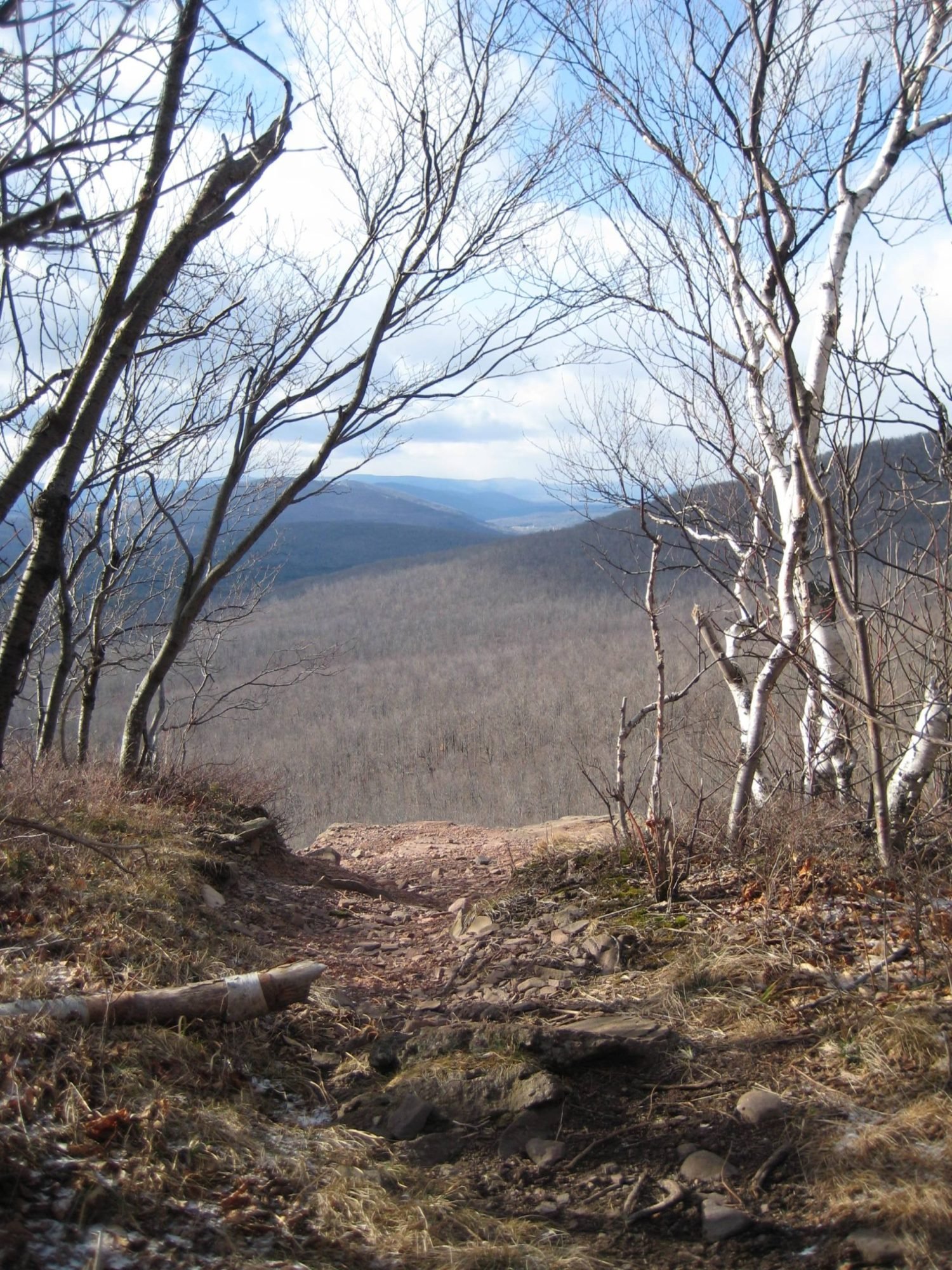
Registration and notes: You must preregister for this hike by June 9. To register, contact Al Purdy by email Albertpurdy1@aol.com or by phone (845) 489-2332. Heavy rain for the day or severe thunderstorms will cancel the hike. Dogs are not allowed on this hike. Maximum number of hikers is 12.Directions: From the NYS Thruway, take Exit 21 (Catskill); turn left from thruway entrance road and proceed a half-mile and turn right on State Route 23 (west). Follow Rte. 23 west for 19.5 miles and the Escarpment Trail/ Elm Ridge Parking Area is on the right, at the intersection with Cross Road. From Route 23 West, the trailhead is located east of the hamlet of Windham, 2.5 from Route 296 on the left side of the highway. GPS Coordinates: N 42.31259 W 74.19040
Cycle the Upper Pepacton Reservoir June 14, 5:00 PM
Meet at the Shavertown parking area for a 20-mile road cycling loop on State Route 30 and the BWS Roads toward Margaretville. We will ride at a moderate pace (14-17mph) for approximately 1 hr. 20 min. Participants will need a road bike, water, snacks  for the ride, and should have equipment to repair a flat tire. This ride is rated moderated - difficult.
Preregistration is required. Register by contacting Peter Manning via email Peter@catskillmountainclub.org by 8:00 PM on June 13. If the weather is bad, participants will be notified on the morning of June 14. If the weather looks favorable for the following evening (Thursday, June 15), we will ride at 5PM.Location and directions: The Shavertown parking area is located on NYC BWS Rd. 4, at its junction with State Route 30 (GPS Coordinates: 42.089561, -74.818429.) From the east, take Rte. 30 west from Margaretville. After three miles stay on Route 30 by turning left; then go another eight miles and turn right on BWS Rd. 4. The parking area is immediately on the left. From the west, take State Route 30 from Downsville. Go 14 miles, cross the reservoir, and turn left on BWS Rd. 4. The parking area is immediately on the left. From Andes, take County Highway 1 (becomes BWS Rd. 4) for almost eight miles and see the parking area on your right just before the stop sign/ junction with Route 30.
Hike the Shavertown Trail | Monday, April 17, 2023 @ 10:00 AM
 The Shavertown Trail begins with a moderately difficult climb to a woods road. From there it climbs gently to a lovely pond and beautiful views of the mountains over the Pepacton Reservoir. Beyond the pond is a moderately easy hike to the Tremperskill Overlook with another sweeping view of the valley and the reservoir. Event Duration: 3 miles, 4 hoursLevel of Difficulty: Moderate; 900′ elevation gain.Leaders: Wendell GeorgeRegistration required by April 15. Register by contacting the leader. See below.Group size is limited to 12, so register early.Bring: good hiking shoes, plenty to drink, lunch, moisture wicking layers that can be shed or added as neededDogs allowed: YesQuestions about this event can be directed to: Wendell@catskillmountainclub.org or 845-514-6959Driving Directions: From Margaretville follow SR 28/30 west to the intersection where SR 30 turns south (left). Follow SR 30 to the Shavertown Bridge. Immediately before crossing the bridge, turn north (right) to the parking area on the left.From Andes take CR 1 south to the Shavertown parking area on the right, just before the SR 30 intersection.GPS Coordinates: 42.089442, -74.81826
Paddle the West Branch of the Delaware – Saturday, April 22 10:00 AM
Kayak or canoe paddle from Delhi to Hamden on the West Branch of the Delaware River. Join Rick Roberts of the Catskill Mountain Club for this moderately rated eight-mile river trip. The event will begin in Delhi and is expected to take 4-5 hours, including the pre-placement of vehicles.  To register, contact Rick Roberts by email (hikerrick2000@yahoo.com) or by phone (607) 746-9694 by April 18; and read the following information:Event Duration: 8 miles, 4-5 hoursLevel of Difficulty: ModerateLeader: Rick Roberts, Catskill Mountain ClubBring: Water, lunch, your own personal watercraft and paddles, life jacket, rain jacket, an 8' length of rope, and sunscreen.Registration required: To register, contact Rick Roberts by April 18 by email (hikerrick2000@yahoo.com) or by phone (607) 746-9694.Dogs allowed: NoAdditional Information: We will be dropping vehicles off at the take-out site in Hamden prior to starting down the river. The water may be high at the time. If it is too high I will call off the paddle at least 2 days prior. All participants must be familiar with the use of their kayak or canoe. i.e., NO NOVICES for this paddle, please. Rain/snow date: TBD.Directions: Take NYS Rte 28 or NYS Rte 10 to Delhi NY. Launch site is behind the Parts Plus Auto parts store, Kingston St, in Hoyt Park on the river.Maximum Group Size: 10GPS Coordinates: 42.276061, -74.915774
Hike Rochester Hollow on John Burroughs’ Birthday – Monday, April 3, 9:00 AM
Join Peter Manning, CMC Executive Director for a four-mile, round-trip hike to the John Burroughs monument. This easy-moderate walk parallels a stream and follows the old road to the remains of Colonel William Rochester’s estate. The original Burrough’s monument was erected in 1921 following the naturalist’s passing earlier that year. A replica of the original plaque was dedicated in 2013.
The hike is expected to take 2.5 to 3.5 hours. Participants must bring any food or water they need. (See directions below.) To register, email Peter@catskillmountainclub.org by 6PM Sunday April 2.Event Duration: 4 miles, 2.5 to 3.5 hoursLevel of Difficulty: Easy - ModerateLeader: Peter Manning, CMCBring: Water, lunch/snacks, sturdy hiking boots, hiking crampons, snowshoes (as applicable)Registration required by 6PM 4/2/23 . Register by contacting the leader: Peter@catskillmountainclub.orgDogs allowed: No, please.Additional Information: Rain/snow date: TBDDriving and Meeting Directions: The Rochester Hollow Trailhead is located at the end of Matyas Road, which is a road that intersects State Route 28 between Big Indian and Pine Hill. The turn to Rochester Hollow is marked by brown-and-white wayfinding signs on Route 28.GPS coordinates: 42.11992508876182, -74.45160890320108
Annual Ephemeral Wildflower Hike at Kelly Hollow - Saturday, May 6 11:00 AM
This is a chance to find and identify the beautiful Spring ephemeral wildflowers which are so named because they appear in early spring when they flower and fruit and then die back, all in a short period before the trees have had a chance to leaf out. Most hikers never see these flowers because they wait for late spring or summer to get into the woods. We will look for Trillium, Spring beauties, Trout Lily, Hepatica, Violets, Squirrel Corn, Dutchman's Breeches, Jack-In-The-Pulpit and many others. We may also find ramps and some early mushrooms. Kelly Hollow is one of the most beautiful short trails in the Catskills with rocky streams and waterfalls. It has a combination of coniferous and deciduous forests with a lovely, abandoned beaver pond near a lean-to at the top.  Event Duration: About 3 hoursLevel of Difficulty: The trail is an easy to moderate loop of about 4 miles.Leader: Howard RaabBring lunch, and/or snacks, drinks to have at the lean-to (there is a privy nearby), waterproof footwear, and bug repellant.Registration required by May 5th. Register by contacting the leader at - howardjraab@gmail.com. Group size is limited to 10 – please register early.Addt’l info: Leashed or well-behaved dogs are welcome. Questions about event may be director to leader via email. In case of steady rain, the hike will be moved to Sun, May 7th. If in doubt, call before 10:00 am on Saturday, (845) 586-3112.We will meet at the trailhead at 11:00 am. GPS Coordinates: 42.079007, -74.649885The Kelly Hollow Trail is located on Millbrook Road in the town of Middletown, NYNJ Trail Conference map #142, F-5,6.Directions to trail-head: 2.2 miles West of Margaretville on Rt.28 go left across from the Old Stone School house and then right on the NYC reservoir road (BWT10) for 3.7miles. Then left on Millbrook Road for 5.3 miles to the trail-head parking area on the right.
Ashokan Quarry Trail Hike on Saturday, May 13 at 10:00 AM
Interested in becoming a CMC event leader? Then this event is for you. The Catskill Mountain Club is seeking event leaders for our 2023 season. If you are considering leading a CMC hike or other activity, please join us for a two-mile hike at the Ashokan Quarry Trail.This will be a casual walk to discuss CMC events and to enjoy the historical features along the way.We’ll explores some of the old works used to build the Ashokan Reservoir morethan a century ago. The hike is expected to take about 2 hours. Please bring lunch and something to drink. (See directions below.) To register, email wendell@catskillmountainclub.org by 6PM on Friday, May 12Event Duration: 2 miles, 2 hoursLevel of Difficulty: EasyLeaders: Wendell George and Peter Manning, CMCBring: Water, lunch/snacks, sturdy hiking boots.Registration required by 6pm 5/12/23. Register by contacting: Wendell@catskillmountainclub.orgDogs allowed: No, please.Additional Information: =Any notification of cancellation will be made on 5/12. Rain date: 5/21/23 10amDriving and Meeting Directions:From points west of the Ashokan Reservoir, take State Route 28 east to Boiceville; turn right on Route 28A and proceed 7.8 miles and the trailhead parking area is on the right. From points east of the Ashokan Reservoir, take State Route 28 to Shokan and turn left onto Reservoir Road, following the brown and white signs for Ashokan. Cross the reservoir, proceed downhill and stay straight on Route 28A west, going past Route 213 and the Promenade parking area. The trailhead parking area is on the left, 4.5 miles from State Route 28GPS coordinates: 41.9355188055, -74.2287689793
Hike Balsam and Eagle Mountains – Saturday, May 20 2023 8:30 AM
This is a strenuous 10-mile hike up to Balsam (3,610 ft) and Eagle (3,610 ft). We'll take Mine Hollow Trail (yellow) to Balsam via the Pine Hill West Branch Trail (blue), looping up to Balsam Mountain to its overlook point. After Balsam, we'll head over to Eagle and climb Haynes Mountain en route (one of the Catskill 100s). While there isn't a view at Eagle it’s a very nice walk in the woods! After Eagle, we'll retrace our steps and return to our cars via the Rider Hollow Trail (red). There are a couple of streaming crossings which may or may not be difficult towards the end of our hike so please make sure to wear waterproof shoes.Event Duration: 10 miles, 7 hoursLevel of Difficulty: DifficultLeader: Siu S YuenBring: 2 liters of water, lunch/snacks, sunscreen, bug spray and most importantly, sturdy waterproof hiking bootsRegistration required by 6PM 5/19/23. Register by contacting the leader: ssyuen@msn.comDogs allowed: NoAdditional Information: Rain Date: Sunday, 5/21/2023; Limit on number of hikers: 12.Driving and Meeting Directions:From exit 19 in Kingston, take State Route 28 west for 34.9 miles to Highmount (top of hill), turn left onto Galli Curci Rd / County Hwy-49A; stay on this road for 4.9 miles, then turn left onto Rider Hollow Rd. and go 2.1 miles to the trailhead/ end of road.From the west, take State Route 28 east past Margaretville toward Arkville and follow the brown-and-white signs for Dry Brook Ridge, turning right on Dry Brook Road. Take Dry Brook Road 4.7 miles, see sign for Rider Hollow, turn left and go one-half mile, see sign for Rider Hollow, turn right and go 2.1 miles to the trailhead/ end of road.GPS coordinates of meeting place: N42.1019 W74.5170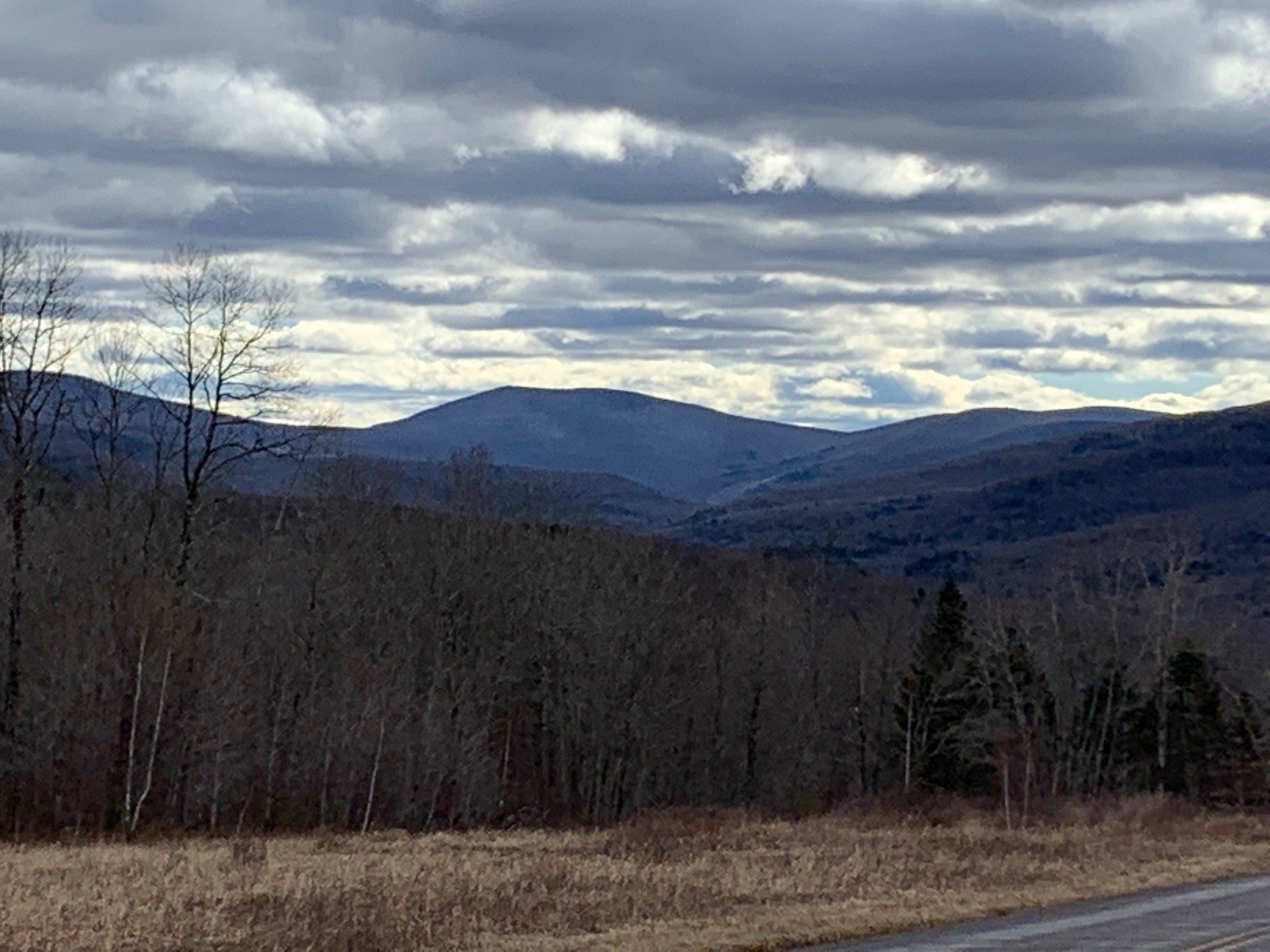
Hike the Trails at Frick Pond | Saturday, May 27, 2023 @ 9:45
 Join us for this lovely hike with moderate uphill climbs and streamcrossings with a varied woodlands display. Features a unique boardwalksection through an old pine forest. We'll visit Hodge Pond, too. Lots of wildflowers in Spring!
Hike pace to be a steady moderate! Some pretty views to stop and admire. Come join the fun day!Hike not for beginners. Please be in good health to attend hike followingCMC guidelines. Group size limited.Event Duration: 7.5 miles, 4 hoursLevel of Difficulty: ModerateLeader(s): Deanna FelicettaBring: good hiking shoes, lunch, snacks, bug spray, plenty to drink, map and compass (recommended).Registration required by May 25th. Register by contacting the leader. See below.Leave full name, reachable phone number and email to register.Group size is limited to 12, so register early.Dogs allowed: Yes, only with permission of event leaderAdditional Information: if any.Registration and Questions about this event can be directed to: felicetta.deanna@gmail.com or call 845-216 2021. NO TEXTING PLEASE! Leave name and number. Please contact leader if you need to cancel.Driving Directions:From Rt. 17 use Exit 96/Livingston Manor. Take Debruce Rd. 6 miles east to Mongaup Rd. Turn north onto Mongaup Rd. 2.5 miles to Beech Mountain Rd. Frick Pond P.A. is about .3 miles.From Rt. 28 in Big Indian turn south onto Oliverea/Frost Valley Rd. and go 19.3 miles to Round Pond Rd., about 1 mile north of Claryville. Follow Round Pond Rd./Willowemoc Rd. 11.6 miles to Mongaup Rd. Turn north onto Mongaup Rd. 2.5 miles to Beech Mountain Rd. Frick Pond P.A. is about 0.3 miles.GPS coordinates: 41.950982, -74.706940
Hike the Huntersfield Creek Falls Trail – Saturday, 2/18/23 9:00 AM
Hike the Huntersfield Creek Falls Trail – Saturday, February 18, 9:00 AM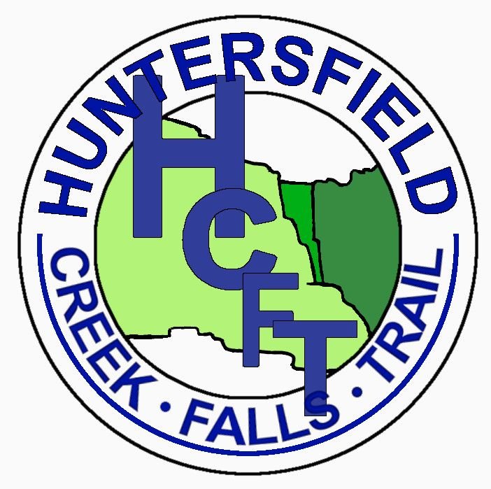 Join Peter Manning, CMC Executive Director; Michelle Yost, Watershed Coordinator, Greene Co. SWCD; and Robert Titus, Geologist for a short hike on the Huntersfield Creek Falls Trail (HCFT) in Prattsville. Discussion will include how the trail was created, watershed protection partnerships, Catskills geology, connecting hamlets and trails, and the status of efforts to restore of Pratt Rock.This two-mile hike is rated easy to moderate and is expected to take 1.5 – 2 hours. Participants must bring any food or water they need, as well as (depending on the weather) winter gear, including microspikes or hiking crampons and/ or snowshoes. (See directions below.) To register, email Peter@catskillmountainclub.org by 6PM Friday February 17.Event Duration: 2 miles, 1.5 - 2 hoursLevel of Difficulty: Easy - ModerateLeader(s): Peter Manning, CMC; Michelle Yost, GCSWCDBring: Water, lunch/snacks, sturdy hiking boots, hiking crampons, snowshoes (as applicable)Registration required by 6PM 2/17/23 . Register by contacting the leader: Peter@catskillmountainclub.orgDogs allowed: NoAdditional Information: Rain/snow date: TBDDriving and Meeting Directions: Prattsville is located on State Route 23, 14 miles west of Windham and 5 miles east of Grand Gorge (connects with State Rte. 30). From State Route 23A Prattsville is 18 miles west of Hunter (connects with State Rte. 214). On-street parking is available along Main Street (Route 23) in Prattsville. The meeting and starting point of the hike is the HCFT trailhead, located one-quarter mile east of the Great American market on the same side Main Street. Walk along the sidewalk to its end point.GPS coordinates: 42.311911, -74.427813
First Day Hike to Kelly Hollow - Sunday 1/1/2022 10:00 AM
 First Day Hike to Kelly Hollow - Sunday 1/1/2022 10:00 AMKelly Hollow is one of the most beautiful short trails in the Catskills with rocky streams and waterfalls. It has a combination of coniferous and deciduous forests with a lovely abandoned beaver pond near a lean-to at the top. The trail is an easy to moderate loop of about 4 miles. Bring lunch and/or snacks to have at the lean-to (there is a privy nearby.)Event Duration: 4miles round trip, 3 hoursLevel of Difficulty: Easy-ModerateLeader(s): Howard RaabBring: good hiking shoes, lunch, snacks, micro-spikes, dress for cold weather, plenty to drink, map and compass (recommended),Registration required by 12/31/22 date. Register by contacting the leader. See below.Group size is limited to 12, so register early.Dogs allowed: Leashed or well-behaved dogs are welcome.Registration and Questions about this event can be directed to: howardjraab@gmail.comDriving Directions: The Kelly Hollow Trail is located on Millbrook Road in the town of Middletown, NYNJ Trail Conference map #142, F-5,6.
Directions to trail-head: 2.2 miles West of Margaretville on Rt.28 go left across from the Old Stone School house and then right on the NYC reservoir road (BWT10) for 3.7miles. Then left on Millbrook Road for 5.3 miles to the trail-head parking area on the right.
GPS coordinates: 42.079007, -74.649885